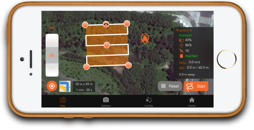
SkyDrones APP
SkyDrones develops custom mobile apps to automate specific projects of our clients.
Check here the free version of SkyDrones App for aerial mapping.
In 2016, SkyDrones launched the first mapping app in Latin America and continues to update it with new functionalities.
Besides this free version, we also develop custom apps and drones to automate specific needs of our clients.
You can turn DJI* drones in a safe tool for mapping, measurement and data capture through flight missions for automatic image capturing.
Join more than 1000 users over 160 countries and become a professional in mapping made easy and quick.

Major functionalities
Check some really cool stuff that you can do with our app:

Mapping
You choose the area that you want to map.More flexibility!
You choose the area that you want to map.

Automation
Start a fully automatic mission.More practicality!
Start a fully automatic mission.

Immediate interruption
Interrupt the mission any time in case of danger.More safety!
Interrupt the mission any time in case of danger.

Settings
You choose altitude, speed, overlapping, camera angle and capture mode.More customization!
You choose altitude, speed, overlapping, camera angle and capture mode.

Widely tested
Supports DJI Phantom 3 and 4 Standard, Phantom 3 Advanced, Phantom 3 and 4 Pro, Inspire 1, Matrice 100 and 600.More reliable!
Online since 2016 with hundreds of users!
Supports DJI Phantom 3 and 4 Standard, Phantom 3 Advanced, Phantom 3 and 4 Pro, Inspire 1, Matrice 100 and 600.

Better images
Geotagged images are taken automatically.More easily!
Geotagged images are taken automatically.
Mission types:
* Available only in the iOS version
You can customize the mission settings:
Other features:
* Available only in the iOS version


